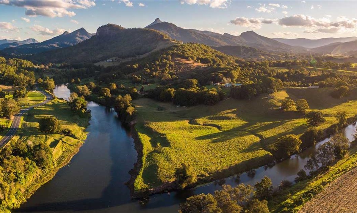
Rivers and creeks
Council works to protect and improve our natural waterways.
Projects include management plans, water quality monitoring, large scale erosion control and revegetation works.
Waterways health reports Awards Estuary management plans River health grants Water quality monitoring Platypus Osprey Additional reading
Tweed waterways health report
View the interactive 2021 Tweed waterways report
 Here you will discover more about the Tweed’s water quality and the different perspectives of aquatic ecosystem health held by Tweed waterway users.
Council produces an annual water quality report card for the Tweed’s waterways, including estuaries, catchment and coastal creeks.
The report card rates the quality of waterways across the Tweed, and Council and community projects.
Previous reports
Sand movement in Cudgera Creek mouth
The timelapse clip below shows the natural variation and movement of sand shoals and the peninsula at the Cudgera Creek mouth.
Tweed River management awards
Thiess International Riverprize
Tweed Shire Council was recognised in 2021 as one of 3 top leaders in global river management at the prestigious 21st Thiess International Riverprize for its work on the Tweed River.
This overview video highlights some of the work done on the Tweed River as part of the Tweed River Management Program.
Tweed River bank stabilisation project
In November 2023, this $620,000 project to protect the Tweed River from future flood impacts and erosion at Uki was completed. The project restored 700 metres of riverbank damaged during the record February/March 2022 flood events.
The project involved installing rock revetment along unprotected sections of riverbank and driving around 1,700 hardwood logs into the riverbed. Works were designed to capture natural sand and gravel to rebuild riverbed levels and prevent ongoing widening and straightening of the Tweed River.
Riparian vegetation will be restored over time to improve river health and reduce the risk of further erosion during future flood events.
North Coast Local Land Services (LLS) provided funding for the project through the NSW Government’s Marine Estate Management Strategy, with the aim of improving water quality for the benefit of marine habitats, wildlife and the community.
Estuary management plans
Tweed River Estuary Management Plan
Council has prepared a 10 year management plan for the Tweed River Estuary(PDF, 10MB). The plan contains detailed background information on the issues affecting the river, and a list of actions that will be implemented to sustain its environmental and recreational values.
A significant number of technical studies were undertaken in the preparation of the management plan. These are listed in the contents.
Please contact Council’s waterways team if you would like to access any of the technical studies on 02 6670 2400.
Tweed Coast Estuaries Management Plan
Council manages the 3 Tweed Coast Creeks that meet the ocean at Kingscliff, Hastings Point and Pottsville. The values of and issues affecting Cudgen, Cudgera and Mooball Creeks are detailed in the Tweed Coast Estuaries Management Plan 2013(PDF, 4MB).
River Health Grants
Council undertakes rehabilitation of waterways on public land, and on private land in cooperation with owners. Council’s River Health Grants program provides support for land owners wishing to undertake work on their property that will lead to improvements in water quality and stream health.
To achieve this, the scheme will supply funding for projects to address typical problems found on our waterways, including bank erosion, unrestricted stock access to waterways, lack of riparian vegetation and weed infestations. To improve the hygiene of our water supplies a priority activity will be to supply fencing materials and drinking troughs for stock throughout the catchment.
Applications can be made by completing the online Expression of Interest form. The next step will be a site visit to assess the potential benefit of restoration projects.
River Health Grants Program fact sheet(PDF, 981KB)
Riparian Habitat for Wildlife fact sheet(PDF, 525KB)
Native plants
Water quality and waterway health monitoring
Tweed River report 2019(PDF, 1MB)
Stormwater pollution guide(PDF, 3MB)
Council recently commissioned two water quality assessments as background studies for a new Tweed River Estuary Management Program currently being prepared.
Both examined compliance with aquatic ecosystem protection targets for the Tweed River and Terranora-Cobaki Broadwaters between 2012 and 2016.
Read the reports.
Find out more about the Tweed River Estuary Management Program.
Council undertakes regular water quality monitoring in the freshwater and estuarine reaches of the Tweed River, and the Tweed Coastal Creeks.
Data is collected and analysed by the Tweed Laboratory, and is regularly reviewed in order to present the findings of these investigations.
The Tweed Laboratory Centre is a multi-million dollar facility offering a comprehensive range of chemical and biological testing for soil and water.
The following reports present these findings.
Tweed and Rous River Water Quality Assessment 2017(PDF, 4MB)
Terranora and Cobaki Water Quality Assessment 2017(PDF, 5MB)
Water Quality Assessment Tweed River Upper Catchment
Upper Tweed Catchment Water Quality Assessment(PDF, 11MB)
Tweed Estuary Water Quality Review 2007-2011 - Final Report
Tweed Shire Council has undertaken a water quality monitoring program in the Tweed estuary since 2007. The data span a wide range of wet and dry climatic conditions and therefore provide a comprehensive picture of water quality variation in the Tweed estuary. This report provides an analysis of temporal and spatial trends in water quality, identifies likely controlling processes and discusses ecological implications.
Full Report(PDF, 5MB)
Executive Summary(PDF, 2MB)
Cudgera Creek and Kerosene Inlet, Fingal Head
Australian Wetlands was commissioned by the Tweed Shire Council (TSC) to undertake a baseline ecological health assessment for the Cudgera Creek estuary at Hastings Point and Kerosene Inlet on Letitia Spit Fingal Head, NSW. The project involved the collection and identification of benthic macroinvertebrates, water and sediment quality assessment as well as on-site assessment of seagrass health.
Baseline Ecological Assessment Report Cudgera Creek and Kerosene Inlet, Tweed Coast(PDF, 1MB)
Cobaki and Terranora Broadwater Ecosystem Health Monitoring Program
This report card shows the results of an estuary health investigation conducted by Tweed Shire Council in Cobaki and Terranora Broadwaters and their catchments. Water Quality and other estuary health indicators, for example sea grass condition, have been measured for 12 months, and the results analysed to provide a description of the overall condition of the entire system.
Report Card 2009(PDF, 7MB) and Technical Report 2009(PDF, 31MB)
Estuarine Vegetation Monitoring
Estuarine Vegetation Monitoring Program(PDF, 1MB)
Older Water Quality Monitoring Reports
Spatially Intensive Approach to Water Quality Monitoring in the Rous River Catchment - Bradley Eyre and Peter Pepperell - December, 1997(PDF, 5MB)
Water Quality in the Upper Tweed Catchment - KEC Science - May 1999(PDF, 3MB)
Tweed River Water Quality Review - WBM Oceanics Australia(PDF, 3MB)
Additional reading
Erosion and sediment control
When it rains, large volumes of soil and sediment are washed into waterways from exposed soil on building, development and road and infrastructure construction sites.
This runoff pollutes the Coast’s waterways and stormwater systems, causing excessive growth of algae, smothering sea grasses and aquatic life and reducing both biodiversity and the value of our recreational fisheries by suffocating or driving away fish. Sediment runoff can also lead to road hazards and localised flooding.
Polluting waterways and stormwater systems also means increased costs to maintain infrastructure and canals. This form of pollution is manageable and can be minimised.
Council has a role to play in educating residents, businesses, builders and developers about the importance of minimising soil and sediment runoff as well as regulating the installation of adequate control measures.
Council seeks to ensure that those who cause land disturbance understand the issues of concern, plan their developments appropriately, and manage their sites in the best way possible to protect the environment and in particular the coast’s waterways. Legislation exists which provides for penalties and the ability for Council to instigate legal action against those who do not use the correct erosion and sediment control measures. This legislation allows for the issue of penalty infringement notices to be issued for certain minor breaches and the serving of notices and orders which may result in court proceedings for major offences causing environmental harm.
Erosion and sediment control for developers
Developers should refer to Development Design Specification D7 - Stormwater Quality(PDF, 552KB) for details of how to manage stormwater during the construction phase to minimise erosion and sediment generation.
Useful links
Question: Do I need permission from Council to undertake erosion control works in tidal waters, including canals?
Answer: Yes. Property owners who wish to undertake erosion control works in tidal waters, including canals, need approval from Council. Property owners who wish to undertake erosion control works in freshwater reaches of the Tweed River or one of its tributaries will need consent from the NSW Office of Water.
Tidal wetlands and fish habitat
Large areas of the lower Tweed River estuary are comprised of tidal wetlands, including seagrass, mangroves and saltmarsh. These areas are extremely valuable fish habitats. Tidal wetlands are protected by NSW legislation.
Riparian vegetation
The Importance of Riparian Vegetation to the health and stability of aquatic systems.
Riparian Vegetation(PDF, 85KB)
River management educational resources
Please select the required educational resource from the list supplied below:
Tilapia in the Tweed River catchment
Tilapia fish are considered one of the world's 100 worst invasive species. Recent spread in the Tweed means early reporting by people working on or around waterways is critical. Read this factsheet(PDF, 462KB) to learn what they look like and what to do if you see or catch a suspected tilapia. Report sightings to:
- 24 hours: Emergency Animal Disease Hotline - 1800 675 888
- Business hours: aquatic.biosecurity@dpird.nsw.gov.au
Tweed River entrance sand bypassing project
The Tweed River Entrance Sand Bypassing Project is a sand transport system that collects sand from the southern side of the Tweed River entrance and pumps it under the river to outlets on the northern side. From there sand is transported by wave currents to nourish southern Gold Coast beaches. This process also aims to keep the entrance to the Tweed River clear of sand to improve navigation for boats.
Please visit tweedsandbypass.nsw.gov.au for more information.
Tweed Landcare
Tweed Landcare